Victoria, BC and its surrounding area is a hiker’s paradise. From the rugged coastline to the dense forests and rolling lowlands, Victoria has it all. If you’re moving to Victoria and love to spend time outdoors, you’ll feel right at home here on the Lower Island.
It’s this outdoor life filled with natural beauty that attracts so many visitors and residents to Victoria. And the best part is you don’t have to travel far from the city to find yourself in the middle of the wilderness, surrounded by stunning landscapes, animals, mountains and ocean. Just a 20-minute drive outside downtown Victoria offers some incredible hiking.
In this article, we’ll share some of Victoria residents’ favourite hikes and trails around the city:
Jocelyn Hill
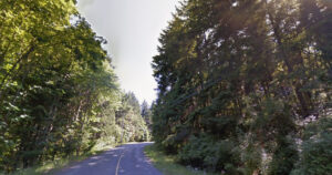
Jocelyn Hill trail is located in the Highlands, on the eastern edge of the Saanich Peninsula. With the loop being around 8km from start to finish, this hike is considered a moderately difficult one. There are lots of ups and downs, so make sure you have a few hours. The peak is over 400m above sea level, but you’ll do most of the hard work in your car just getting to the parking lot.
You’ll definitely encounter other hikers and their leashed dogs on this popular trail. The best part about the Jocelyn Hill trail is the stunning view of the Saanich Inlet at the top. Towering over the Inlet, you’ll be looking down into the deepest fjord on Vancouver Islands east coast. Jocelyn Hill is also a great trail for birdwatching. Even black bears and cougars are known to live in the area, but they’re pretty good about staying away from all the commotion.
Around 20 kilometres from downtown, this hike is what Victoria residents would call “a bit of a drive”, being about 30 minutes away. But Langford residents are much close, able to reach Jocelyn Hill in 15 minutes.
> Find Jocelyn Hill on Google Maps
> Learn more about Jocelyn Hill on AllTrails
Directions: Take the Trans-Canada Highway north and exit at #14 for Langford/Highlands. Stay right and turn right onto Millstream Road. Stay on Millstream as it winds through the Highlands for about 6km. Watch for signs to Gowlland Tod Provincial Park and turn left onto Caleb Pike Road. A gravel parking lots will await you at the end!
Thetis Lake Regional Park
Thetis Lake is one of the most popular hiking spots in the city, all year round. With over 45km of trails of various length wrapping around Thetis Lake, with the shortest being just over 4km, Thetis has a little something for everyone.
Thetis Lake itself is hugely popular among kayakers, kids, dogs and hardcore swimmers. Come in the summertime, and you’ll be pressed to find parking anywhere near. Although still used as a hiking and dog walking trail, Thetis transforms into a summertime beach paradise for people of all ages from June through August.
Thetis’ popularity is due in part to its excellent proximity to downtown Victoria and Langford. Located just off the Trans-Canada Highway on the way to Langford, Victoria residents can reach Thetis in under 20 minutes. That distance is even shorter for Langford residents.
> Find Thetis Lake on Google Maps
> Learn more about Thetis Lake on AllTrails
Directions: The take Trans-Canada Highway north until exit #10 for View Royal/Colwood. Stay straight on the Old Island Highway a short distance until you reach Six Mile Road. Turn right at the light and continue straight until you reach the sign and parking lot.
East Sooke Park
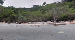
The East Sooke Park is probably the most remote on this list, and arguably the most beautiful. Located in the municipality of Sooke, well out of the city at the very southern tip of Vancouver Island, it’ll take you the better part of an hour to reach the park. But the trip is well worth it – make sure to bring your camera!
East Sooke Park is home to over 50km of trails, with the most notable being just 10km along the rugged coastline. This several hour hike is quite challenging, with plenty of ups and downs and rocky terrain, but the stunning ocean views are well worth it. There’s another less challenging hike that’s just a 6km round trip, and still offers views of beaches and jagged coves.
Being one of the more remote destinations on the Lower Island, East Sooke Park is home to tons of wildlife. It’s a great place to spot bald eagles, waterfowl, rodents, birds and cougars – make sure you practice safe trail habits.
> Find East Sooke Park on Google Maps
> Learn more about East Sooke Park on AllTrails
Directions: Take the Trans-Canada Highway headed north and exit at #10 for View Royal/Colwood. Stay in the left lane and continue straight onto Sooke Road, past the malls and into Sooke. You’ll make a left on Gillespie Road after seeing signs for the park. Follow the road to the end and turn left on East Sooke Road. Turn right on Belcher Bay Road and travel to the end.
Mount Finlayson
Mount Finlayson is another extremely popular hiking spot in Victoria. Located just a few minutes along the Trans Canada highway past Langford, the mountain is pretty accessible for both Victoria and Langford residents.
One of the main reasons this hike is so popular is because its steep incline – it’s a great workout that can be finished in under an hour. Mount Finlayson will have you climbing just over 400m, and it’s mostly straight up. Especially on the weekends, you’ll run into plenty of people and dogs on this trail.
This hike is definitely not an easy one, and requires sure footing and decent cardio. There are spots of the hike where you’re exposed to steep, rocky cliffs that could result in a fatal accident if you aren’t careful.
> Find Mount Finlayson on Google Maps
> Learn more about Mount Finlayson on AllTrails
Directions: Take the Trans-Canada Highway north all the way for about 20km until it becomes single lane. From there watch for the turn-off to Goldstream Park on the right hand side. The trail starts about 200m from the parking lot, just across the bridge.
Kinsol Trestle Trail
The Kinsol Trestle Trail is one of the shorter, more accessible hikes on this list. At just 3km from start to finish, you’ll be finished this hike in under an hour no problem. Along with hiking, the area is open to horseback riding and cycling. There are also picnic spots, washrooms and special viewing platforms.
The trestle itself is the largest and most impressive along the Cowichan Valley Trail route (there are 8). At 187m long and 44m high above the Koksilah River, Kinsol is one of the tallest free-standing timber rail trestle structures in the world.
The Kinsol Trestle Trail is furthest away in this list, located just past Shawnigan Lake. From Victoria, you can reach the trail by vehicle in a little under an hour.
> Find Kinsol Trestle on Google Maps
> Learn more about Kinsol Trestle on AllTrails
Directions: Take the Trans-Canada Highway north all the way until you reach Mill Bay/Shawnigan Lake Road. Turn left and follow the road all the way to the Village of Shawnigan Lake. Turn right onto Shawnigan Lake Road, which turns into Renfrew Road. Follow Renfrew Road past the end of the Lake to Gleneagles Road and turn right. There will be a parking lot to your right.
Mount Work Regional Park
The sixth and final hike on our list is Mount Work Regional Park. Mount Work is a massive park located off the Saanich Peninsula with a summit of 449m, complete with 11km of hiking trails, three freshwater lakes and a designated mountain bike park.
Durrance Lake is one of the three lakes in the park, and is extremely popular in the summertime. Here, people flock for swimming, sunshine and even fishing, as the trail is stocked with catchable Rainbow Trout.
Mount Work is located near the Saanich Inlet, past Camosun College and past Prospect Lake. From downtown Victoria, it’ll take you just above 20 minutes to reach the park. Saanich residents will have a much shorter drive.
> Find Mount Work on Google Maps
> Learn more about Mount Work on AllTrails
> Directions: Head northbound on the Trans-Canada Highway and exit at #14 for Langford/Highlands. Turn right and drive along Millstream Road for a while, then turn right on Munn Road. Follow Munn Road for about 2km before you’ll see signs and a gravel parking lot where the trail starts.